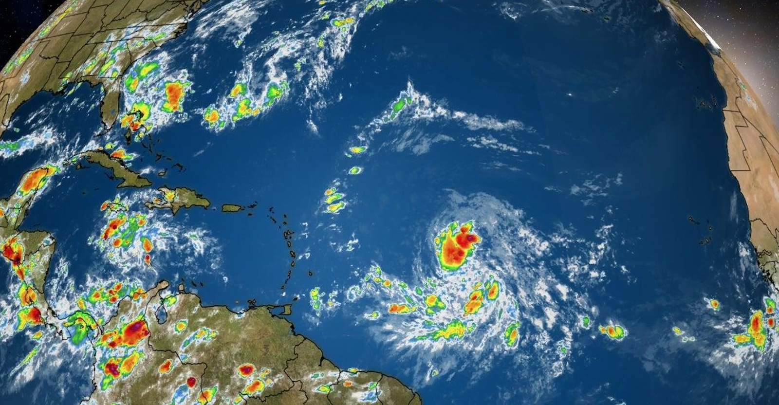
NASSAU, BAHAMAS — A tropical depression formed overnight and is expected to bring rain and possible thunderstorms to the southern islands of The Bahamas by Saturday.
When contacted yesterday, Chief Climatological Officer Michael Stubbs said the then-disturbance is projected to pass over the southern Bahamas Saturday evening and adverse weather conditions could be experienced across the entire Bahamas throughout Sunday.
He said: “By Sunday, the entire Bahamas could experience increased rain and thunderstorms throughout Sunday.”
At the time, Stubbs said it was unclear whether the disturbance could develop further into a named storm, but he noted the potential exists as he encouraged residents to prepare accordingly.
Based on some available modeling, the projected path of the disturbance could traverse the archipelago from south to north.
Others project the system could pass over the southeastern islands and parts of Andros as it moves northwesterly.
But the majority of guidance models on the early-cycle track show the disturbance passing south of The Bahamas and over Jamaica and Cuba.
As of 11pm, Tropical Depression Thirteen was moving west northwest at 20 mph, with maximum sustained winds of 35mph.
The National Hurricane Centre said the depression was likely to stay on a fairly quick west-northwest track during the next several days, taking the cyclone near the northern Leeward Islands by Friday night and near the Greater Antilles and southeastern Bahamas this weekend.
“The environmental conditions appear generally favorable for the depression to strengthen, with the wind shear expected to remain relatively low while the system moves over warm SSTs (sea surface temperatures) and remains in a moist airmass,” the centre said.
“These conditions should promote gradual strengthening and it seems quite likely that the cyclone will be a tropical storm when it moves near or north of the northern Leeward Islands in a couple of days.”
It added: “The bigger question is how much interaction will there be with the Greater Antilles. If the depression moves on the south side of the guidance envelope, further strengthening would be limited due to land interaction.”
As of 8pm, another weather disturbance located over Guinea, Africa, is expected to develop as it reaches the extreme eastern Atlantic on Friday. However, meteorologists expect conditions to become less favorable next week for tropical cyclone formation.
At last report, the weather disturbance had a 40 percent chance of cyclone formation over the next five days.
A third disturbance over the central Caribbean Sea was causing showers and thunderstorms.
It had a 70 percent chance of further development over the next 48 hours.
Some gradual development was expected over the next day or so while it moves westward across the central Caribbean, following which is expected to move slowly west-northwestward and become a tropical depression later this week when it reaches the northwestern Caribbean Sea.
In a statement after 1pm Wednesday, the National Emergency Management Agency (NEMA) said it was closely monitoring the weather disturbance projected to “threaten The Bahamas within the coming days”.
“Residents throughout The Bahamas are being advised to closely monitor the progress of this system and to heed local advisories,” NEMA said.
Amid widespread public backlash and protests over an immediate seven-day lockdown in New Providence,Prime Minister Dr Hubert Minnis announced Tuesday a turnaround of the measures imposed, allowing food stores and other essential services to open Wednesday.
He said the reversal was due to public feedback and the development of a weather system that could potentially impact the country by the weekend.


