
Storm expected to bring thunderstorms, swells to southeast Bahamas
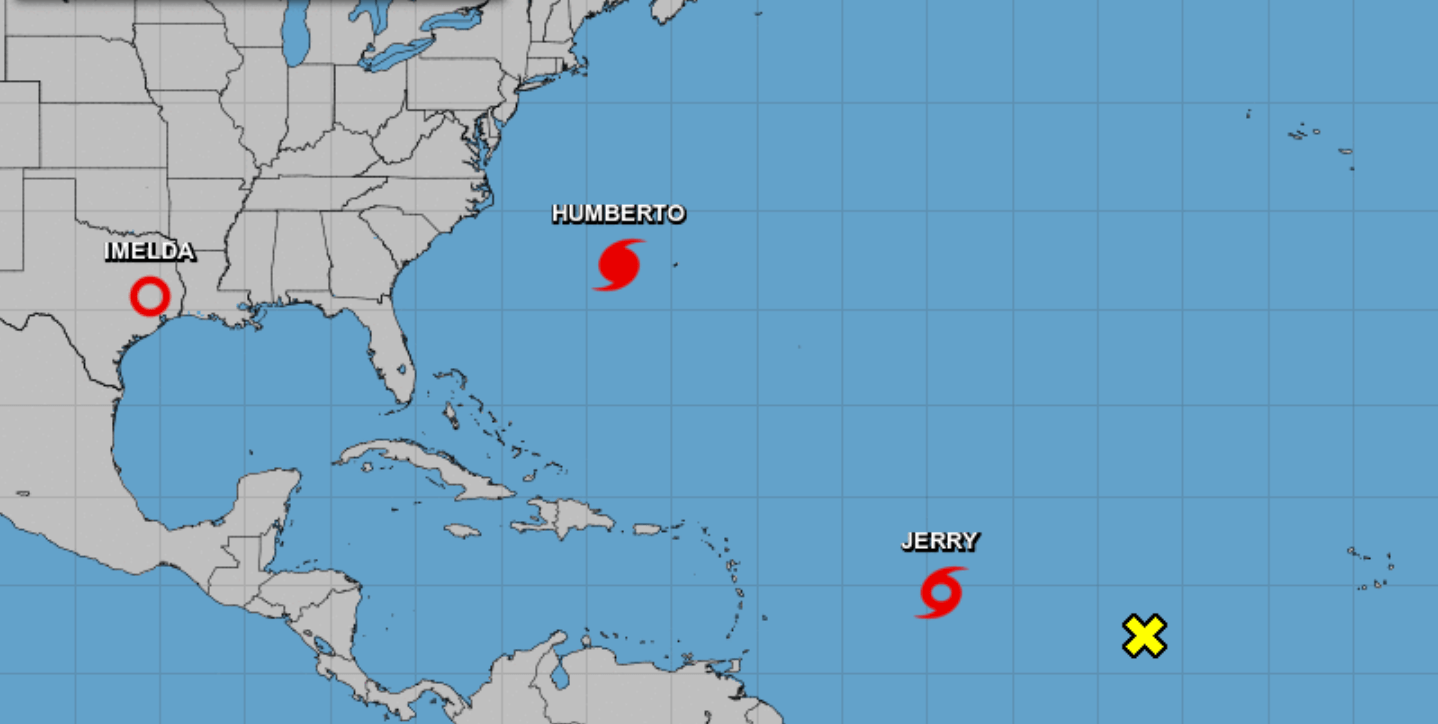
NASSAU, BAHAMAS — Tropical Storm Jerry, the tenth named storm of the 2019 Atlantic hurricane season, formed today and is anticipated to strengthen into a hurricane by the end of the week as it makes its way toward The Bahamas, according to the National Hurricane Center.
When contacted about Jerry’s possible impact on The Bahamas, meteorologist Greg Thompson said the storm is expected to remain east of the islands of The Bahamas and “stay east of our area”.
“The closest point will be the southeast Bahamas when it is a hurricane — that’s Sunday – mostly likely we will be getting some rain bands out of across the southeast Bahamas; Turks and Caicos Island as well, but by the time it makes that turn toward the northwest and then north, it should be moving away from us, so we will probably not see much in terms of significant weather with it. The only conditions that we expect out of the system will most likely be large swells associated with the storm.”
The southeast islands include, Acklins, Crooked Island, Mayaguana and Inagua.
Ragged Island in the southwest could also be impacted by inclement weather, including thunderstorms.
Thompson urged residents to monitor the weather forecasts closely for any changes.

As of 11 a.m. Jerry was around 855 miles east of the Leeward Islands.
It was traveling west, northwest at 14 miles per hour.
It had maximum sustained winds of 50 miles per hours.
While there were no coastal watches or warnings in effect as it was “too soon to determine the direct impact to the islands”, the National Hurricane Center anticipated that watches could be issued for a portion of the area this afternoon.
The storm is projected to become a Category 1 hurricane by late Thursday with little change in strength Friday and Saturday.
The center said Jerry is “expected to strengthen and be a hurricane when it moves near the northern Leeward Islands Friday, although it is too soon to determine the direct impact to the islands. Interests there should ensure they have their hurricane plan in place and monitor the progress of this system. Watches could be issued for a portion of this area this afternoon or this evening”.
On its present track, Jerry is expected to near the Leeward Islands Friday and pass north of Puerto Rico on Saturday.
Tropical storm winds extend outward up to 45 miles from the center of the storm.
The nation is still reeling from the widespread destruction, displacement and deaths in the aftermath of Hurricane Dorian, a Category 5 storm that smashed the islands of Abaco and Grand Bahama on September 1-3.
It was the fourth named storm of the Atlantic hurricane season.
It was among the most powerful storms on record to impact The Bahamas.
Last week, a weather system known as ‘nine’ formed into a named storm: Tropical Storm Humberto which threatened to bring strong winds and heavy downpour to the central and northwest Bahamas.
With Abaco leveled and Grand Bahama ravaged, there was high anxiety about the storm’s impact on the islands and the ongoing search and recovery efforts as government agencies and their regional and international partners continued humanitarian efforts.
The storm shifted to the east with the first 72 hours of forming, moving close to Abaco and offshore the east coast of Florida.
The system brought showers and thunderstorms over both Abaco and Grand Bahama.
The season runs from June 1 to November 30.

