
Local meteorologists expect Josephine to enter hostile conditions and de-intensify
NASSAU, BAHAMAS — A tropical depression in the Atlantic is expected to develop into a tropical storm later on today, according to the National Hurricane Center.
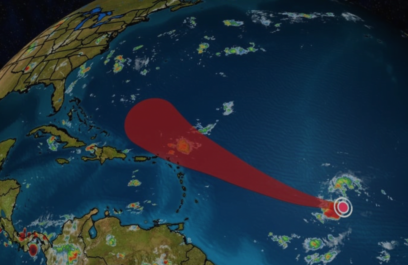
The system, upgraded to ‘Tropical Depression Eleven’ Tuesday afternoon was east-southeast of the northern Leeward Islands and moving west near 14 miles per hour as of 11am today.
“A turn toward the west-northwest at a similar forward speed is expected tonight, with this motion continuing through the rest of the week,” the hurricane center said.
It has maximum sustained winds of 35 miles per hour.
“Gradual strengthening” is forecasted during the next 48 hours.
The depression is expected to become a tropical storm later today.
If reclassified, it would be named Josephine.
On its forecast track, the system is expected to pass northeast of Haiti and the islands of The Bahamas by next week Monday around 8am.
The Bahamas is not projected to be in the cone of the system, however, the hurricane center warned that “hazardous conditions” can occur outside of the cone.
When contacted, Chief Climatological Officer Michael Stubbs told Eyewitness News modeling projects the system could declassify into a tropical depression again as it gets near the southeastern Bahamas on Monday.
“It is going to encounter as it gets nearer to the eastern Caribbean islands, just off shore there. it is going to encounter some hostile weather conditions — that is dry air and some wind shear between now and I would say Saturday or thereabouts,” he said.
“It will gain strength and then it is expected to weaken again based on the moderate projections because of the hostile conditions.”
It was pointed out that Tropical Storm Isaias was expected to weaken as it passed over Hispaniola, but strengthened into a hurricane as it passed over the central and northern islands.
The storm lashed The Bahamas with strong winds and caused moderate flooding in several islands, though reports of damage were minimal.
Stubbs acknowledged that despite the projections to de-intensify, this may not happen.
“That is the reason why I have been looking at multiple model runs to see what they expect
“The global forecast model, known as the GFM, projected it to come very close to the eastern shoreline of The Bahamas, but the European model which seems to be the one that ideally gives us a better run, a better prognostication, has it to pass more east of the islands, out in the Atlantic. If anything, we’re probably get some rain from it and an increase is windy conditions for the most part, but nothing to be really, really concerned about.
“But as you said, we watch these things closely because they can change overnight.”
Stubbs encouraged residents across the archipelago to make all preparations, noting the ongoing hurricane season and the increased activity projected.
An eastern moving pulse of cloud and rainfall known as the Madden-Julian Oscillation is expected to impact The Bahamas around August 18, 2020, according to Stubbs, who said the conditions are favorable for “enhanced tropical cyclone activity for the region”.
A tropical depression is classified as a named storm when wind speeds reach between 39 miles per hour and 73 miles per hour.
No coastal watches or warnings were in effect for ‘Tropical Depression Eleven’.

