
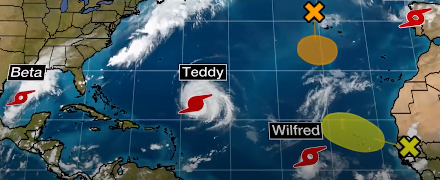
NASSAU, BAHAMAS — A Category 3 hurricane that has formed in the Atlantic is not projected to impact The Bahamas, and will instead veer north toward New Brunswick, and adjacent US states, according to the National Hurricane Center.
Teddy was moving northwest at 14 miles per hour and is forecasted to approach Bermuda late Sunday or early Monday.
The storm has maximum sustained winds of 125 miles per hour.
Meanwhile, Tropical Storm Wilfred was around 735 miles from the Cabo Verde Islands. It was moving west-northwest at around 18 miles per hour and has maximum sustained winds of 40 miles per hour.
“Wilfred could strengthen some during the next day or so before increasing upper-level westerlies winds likely begin by Sunday,” the center said.
“A gradual weakening is expected into early next week, though the model guidance is in worse agreement than the last advisory due to the positioning of an upper-level low.”
Wilfred is the final named storm of the 2020 hurricane season.
Two additional storms in the Atlantic have been named Alpha and Beta.
Alpha was around 120 miles north-northeast of Portugal.
It was moving northwest at 28 miles per hour.
Alpha is expected to move across northern Portugal and Spain before dissipating on Saturday.
Beta was 335 miles east-northeast of Tampico Mexico.
Beta is moving toward the north-northeast at nine miles per hour.
On the forecast track, the center of Beta will approach the western coast of the Gulf of Mexico Sunday night and Monday.

