

NASSAU, BAHAMAS — Meteorologists project Tropical Storm Fred could weaken to a tropical depression before strengthening again on Tuesday as it eyes Florida.
Due to the projected weakening, the Department of Meteorology has maintained its tropical storm watch for the southeast Bahamas, according to Department of Meteorology Senior Deputy Director Jeffrey Simmons.
“That is not really expected to survive much from Hispaniola,” he told Eyewitness News yesterday.
“Of course, when the system relatively weakened was [as] it goes over Hispaniola.
“That’s the reason why we never went with a warning for The Bahamas.
“As it passes just south of places like Inagua, we just expect it to be a tropical depression at best, and maybe even a low.
“They are going to get some showers and that’s about it.”
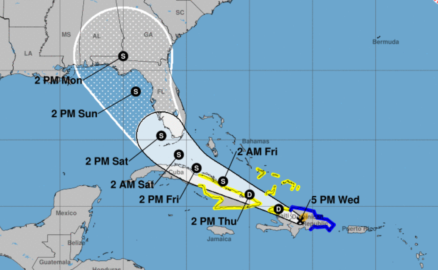
As of 5pm yesterday, Fred was located 75 miles west-northwest of Santo Domingo, Dominican Republic, and around 210 miles southeast of Inagua.
The storm was moving west-northwest at 15 miles per hour and had maximum sustained winds of 40 miles per hour.
A tropical storm watch remains in effect for the southeast islands.
Tropical Storm Fred brought heavy rainfall between three to five inches and flooding risk to the Dominican Republic yesterday afternoon.
Over Haiti, eastern Bahamas and Cuba, one to three inches of rain are expected, with isolated maximum rainfall of five inches.
The evening advisory read: “Tropical storm conditions should continue over portions of the Dominican Republic for a few more hours. Tropical storm conditions are possible along the northern coast of Haiti, the Turks and Caicos and the southeastern Bahamas beginning tonight. Tropical storm conditions are possible in Cuba beginning Thursday.”
Meanwhile, meteorologists were watching a tropical wave located several hundred miles west-southwest of the Cabo Verde Islands.

The disturbance, which could reach portions of the Leeward Islands by Saturday, has a 30 percent chance of further formation over the next 48 hours and a 50 percent chance of development over the next five days.
Simmons told Eyewitness News: “We are still watching that, but that’s a bit soon to look at right now.
“We see it there and we are watching. We’re focusing more on Fred right now, and it seems as if by the end of the day, Fred would be a depression.”
According to the hurricane center, a tropical depression could form early next week while moving generally westward.

